 |
| Bryce Canyon |
As we missed the lottery to The Wave and
North Coyote Buttes, we went with plan B: Zion National Park. But befor, we headed to Bryce Canyon National Park.
Bryce Canyon is about 2
hours’ drive to the north from Kanab. Passing the pink-orange walls of
Vermiliont Cliffs and the Coral Sand Dunes, we arrived to Dixie National Forest before
Bryce Canyon. Dixie National Forest is the beginning of the Martian view of the Bryce
Canyon. Here the tall pine trees still cover the orange hoodoo
statues at places, but arriving to Bryce Canyon (after 2 tunnels dug from the
orange rocks above the road), the Martian view can be enjoyed in full.
 |
| tunnel on scenic byway 12 |
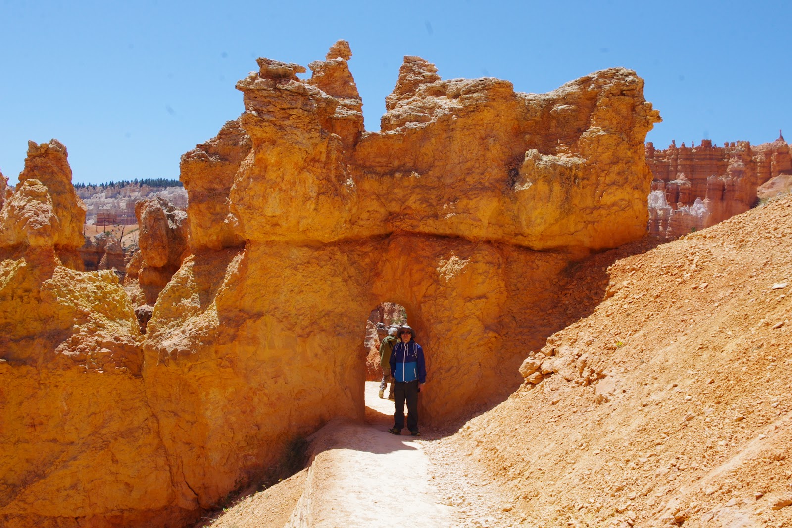
The main characteristics of the Bryce
Canyon National Park are the hoodoos – these strange, chessman-like statues are
formed by frost weathering and stream erosion. The hoodoos get their shape as a
harder layer on the top resists better than the softer lower layers to the
erosion, forming a chessman-like shape finally. The Martian feeling is from the
color of the surrounding rocks: the orange, red, white color can be seen all
around the Grand Escalante (Bryce Canyon is part of this sedimentary rock
layer) – the color comes from the high concentration of iron (iron oxide) in
the rocks.
 |
| hoodoos |
The visitor center was right next to the
entrance gates, which was convenient to decide immediately where we wanted to
go. As we had only one day here, we decided only to take a hike in the canyon
(which is officially not a canyon, rather an amphitheater). We chose
the Queen Garden`s Trail which starts from Sunrise point, goes down the valley among the orange walls and hoodoos and took a big loop to Wall Street and then back to Sunset Point from the Navajo Loop Trail. As the canyon is located in 2400m
altitude, in the end of April it was still chilly (cold, strong wind), but as
we got lower to the valley, thanks to the protective walls and columns the wind
stopped and it got nice and warm. This trail was really amazing as it took us
first to Sunrise Point where we could have a good view to the amphitheater – the
overview was really hard to believe to be true: it looks like a huge, orange
chess board or the natural version of the terracotta army of the first Chinese
emperor, Qin Shi Huang.
 |
| on Queen Graden`s Trail |
 |
| on the trailhead of Wall Street |
Going down to the valley and
walking around these hoodoos gave us another perspective – the admiration of
the size of the hoodoos. Although from the view point the hundreds of hoodoos seemed small, but actually one such column can reach 20-30 meters. From below we
enjoyed not only the hoodoos but other formations of the nature, like windows,
arches, bridges. Down in the valley we took the trail to Wall Street (named not after the famous bank district, but rather the fact that the trail climbs up between tall, vertical walls), where a thin but tall pine tree
stands between 2 vertical walls. This trail would have taken us back to the rim, but it was still closed for winter due to danger of rock fall from winter`s erosion. So, we took our way back
and climbed back to the rim on the Navajo Loop Trail. Here we saw the Two Bridges
formation and after a steep serpentine trail up to the rim, we found ourselves
back in line with the “heads” of the hoodoos. Here, at the end of the trail we
found “Thor´s Hammer”, a rock shaped exactly like the Marvel cartoon hero´s
weapon.
After this hike we drove around the park,
stopping at the further view points. Although Sunrise, Sunset, Inspiration and Bryce Points are the most famous due to their closeness to the lodge and visitor center, there are 10 other view points along the road in the park. We stopped by at Bryce Point, , Natural Bridge and Rainbow Point. Rainbow Point is the highest view point at 2778 meters and although the view was spectacular, the wind here was so strong that we
just rushed out of the car, took pictures and ran back. Rainbow Point is called so because already being far enough from the amphitheater the rainbow-arch like position of the hoodoos can be well seen here.
Despite the wind
however, we took our time at Bryce View. For me this was the best spot to take
a view over the park.
 |
| Thor`s Hammer |
We stayed at the Bryce Canyon Lodge, just
outside of the park, so it was easy to go back in the night for stargazing.
Bryce Canyon is said to be one of the best (darkest) parks in the US. Well, I
don´t know the other parks, but Bryce Canyon was indeed great! As soon as we
turned off all the lights in the car, pitch black obscurity fell around us. But
as we looked up the sky opened; not only the countless number of the stars on the sky, but the
number of the falling stars were astonishing. After a while (weather it was 10 minutes or
30, I wouldn´t be able to tell), we headed back to our hotel. On the way, we
saw mule deer venturing forth to the roadsides for feeding. At daylight we´ve
only seen birds (like the beautiful Steller`s Jay) and chipmunks, ground squirrels, but at night as the park becomes quite even
these shy deer can be seen. We also saw a smaller shadow running across the street before us in the dark - by its size it couldn`t have been other than a prairie dog...
 |
| view from Bryce Point |
 |
| Zion National Park |
The next day we headed back to Zion
National Park. Zion is on the way back to Kanab, about half-way to the city from Bryce Canyon. It
is also close to Las Vegas, so we expected more people here. And indeed there
were more people in Zion as in Bryce Canyon.
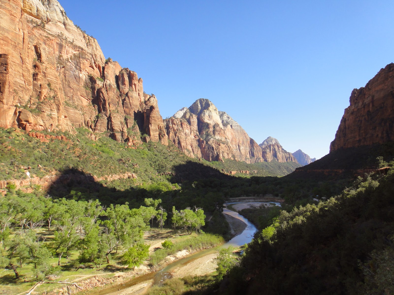
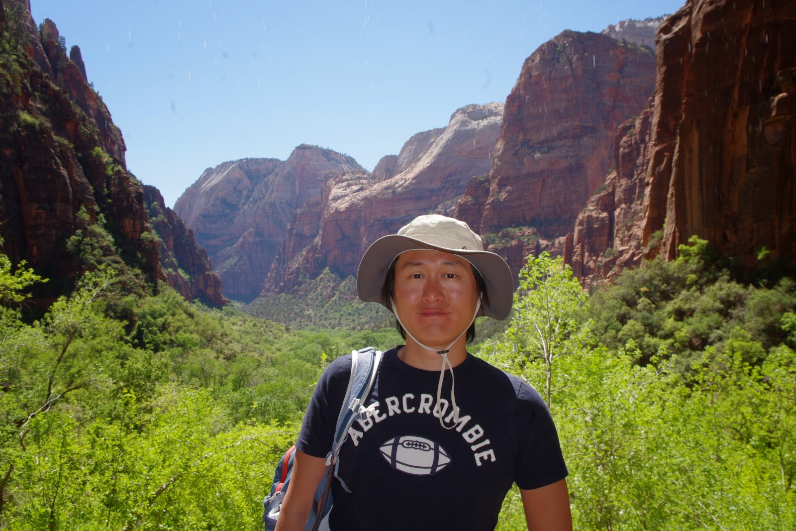
Zion National Park showed another face of
this area. To me it resembled a little to Yosemite Park with its huge rocks and the narrow valley where the road runs. We took the Eastern entrance of the park from I89, which
turned out to be the furthest entrance from the visitor center. But we didn´t
care because this way we could drive around the yellow-pink-orange rocks before
arriving to the center. As the valley is narrow and goes only one road, cars
are prohibited in the valley and visitors have to use buses. Before getting on the
bus we checked out the visitor center to know what we can see here. It was
really useful as the trails were grouped by time – as we had only one day here
as well, we looked for the shorter trails.
 |
| buses took us all around the valley |
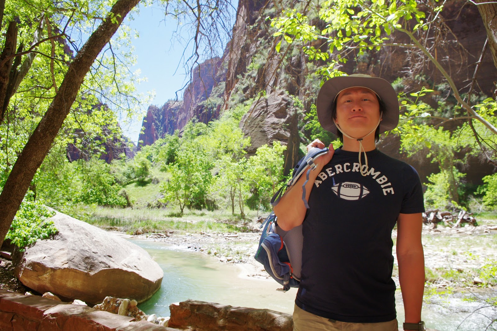
As the Narrows are the most famous trail in Zion, we headed there first. The Narrows goes between two enormous rock
walls (some places towering 600ms tall) but as the trail is mainly on the path of a creek, one needs good
waterproof clothes and boots for this hike. As we didn´t have, we just walked
the 1 mile riverside trail to the river and only crossed the river to catch a glimpse
of the Narrows Trail.
 |
| riverside walk trail |
Although the creek was only ankle-deep, at this
time of the year it was still so freezing that my feet almost froze while
crossing the river. Although the trail seemed really interesting and turned out
that in the visitor center you can rent hiking shoes for this trail, this
really wasn´t the season for this hike. (Even tough, many people took the trail
– I guess their feet were made of steel.)
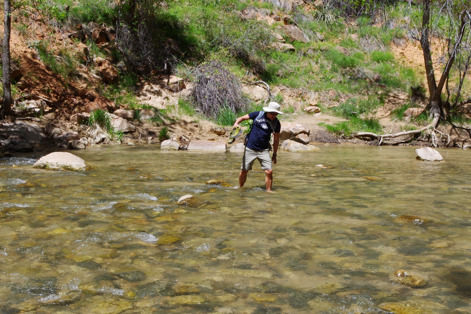 |
| Akinari crossing the cold creek |
So, after a short peek to this trail,
we headed back on the riverside trail that gave us a nice view to the creek flowing
gently between the steep rock walls in the bottom of the valley. On the way we
saw a lot of ground squirrels. They were so used to the people, they walked
with us on the pavement, some of them even tried to steal food from backpacks.
We even saw a “model squirrel” posing us on the top of a rock.
 |
| ground squirrel posing for us |
 |
| weeping rock |
From the nearby bus stop we took a few
stops back to take the Weeping Rock. The bus drivers were really nice here (wish the
bus drivers were the same in the cities): explained the road, showed us rock
climbers (apparently Zion is the Mecca of the rock climbers), pointed out deer
or just generally told some stories about the park. The way to the Weeping Rock was only a few
hundred meters long from the bus stop. It is called so because
water here sprinkles continuously from the rock making it look like it cries.
Thanks to the eternal water supply the vegetation around here was beautiful.
Also, as the weeping rock is a bit on higher grounds, the view to the valley was really nice. As the water sprinkles around from the rocks, it is a great place at summer to freshen up.
 |
| view from weeping rock |
After this short trail we stopped by at Zion Lodge to have a short lunch before heading to our 3rd hike to the
Emerald Pools. Despite their beautiful name, these pools were not emerald green.
Even though it was a nice trail – there are 3 pools (lower, middle and upper)
and one can take only one or all of them, depending time and stamina. As we
still had time, we took all the way up to the upper pool. The lower pool was a
small pond surrounded by red rock walls from where a small waterfall supplied the
water to the pool.
 |
| at lower emerald pool |
Going further, we heard croak – turned out, in the middle
pool there were many frogs giving the visitors free concert. From the middle
pool to the upper the trail became steeper and sandy, but the view became more
and more beautiful with every step.
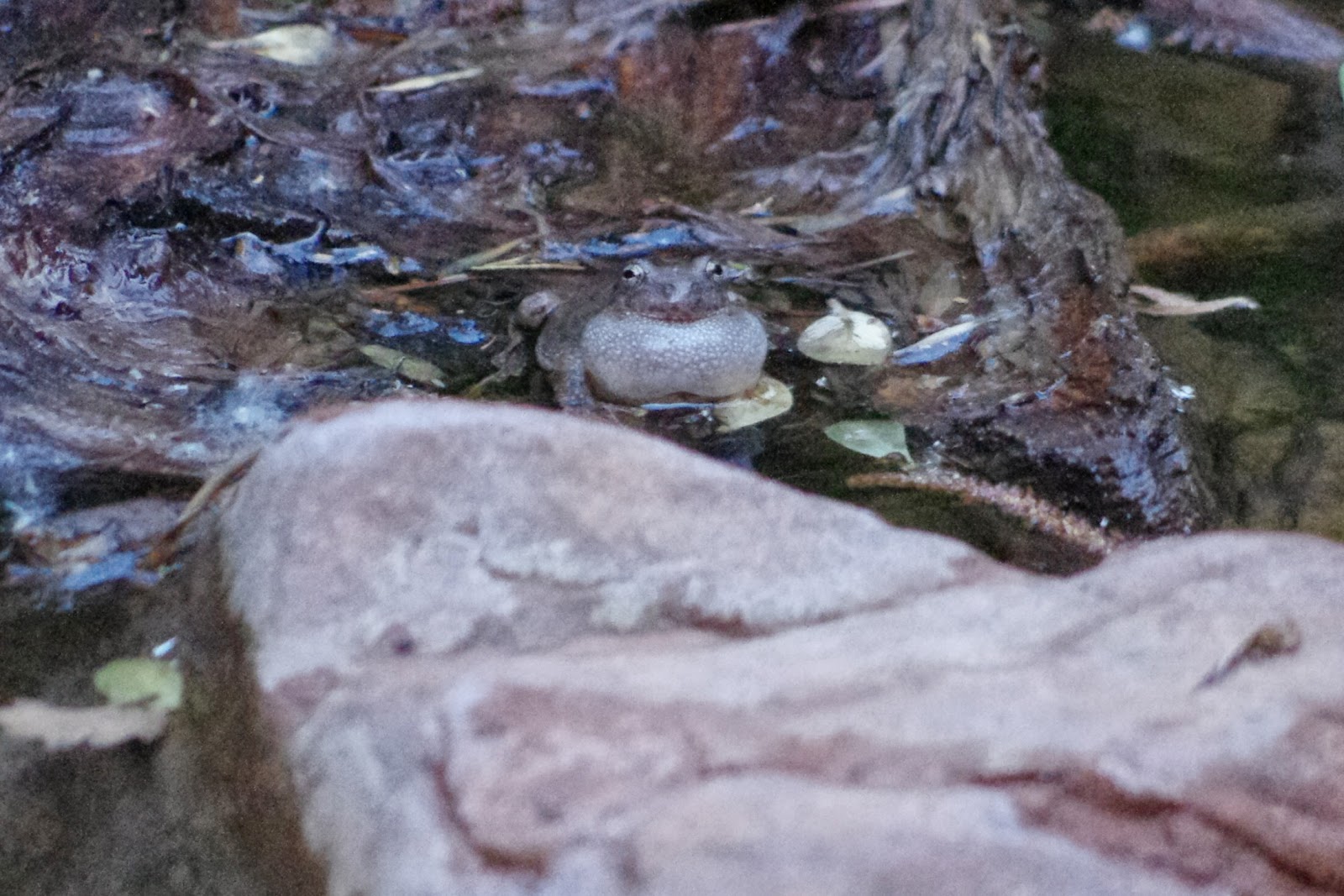 |
| frog concert at middle emerald pool |
The upper pool´s still surface
reflected the 30 meter tall rock wall right behind it. As this high wall
surrounded us almost 360 degrees, the upper pool was quiet and peaceful.
 |
| upper emerald pool |
After
taking a little rest and enjoyed the peaceful atmosphere we headed back to the
visitor center. Not to go back on the same trail, we took a small detour to the Grotto trail. On this trail we had some nice view to Zion valley.
 |
| on Grotto trail... |
 |
| ...and the view |
Right at the end of
the trail there was a bus stop (again, how convenient!) which took us back to
the visitor center. It was around 5pm when we got back to our car – the shadows
already got longer in the valley, but it was still sunny on the top. We stopped
by on the way out at some "Wave"-like rocks and the chessboard rock (really, it
was hard to believe it hadn´t been made by some giant for its chessboard!).
On
the way to the exit there were 2-3 shorter and longer tunnels and at one of
these tunnels we encountered some big horns. Apparently a family was going to
have dinner – some of them crossing the road, some of them elegantly crossing
over the tunnel while eating every plant on the way.
Satisfied and tired we hit the road to
drive about 120 kms back to Page. It was already dark by the time we got to
Page, but as we had spent here 2 days already, we just headed to my husband´s newly-favorite
fast food restaurant (Jack in the box) to have dinner and checked in to our motel.
 |
| night sky in Page |
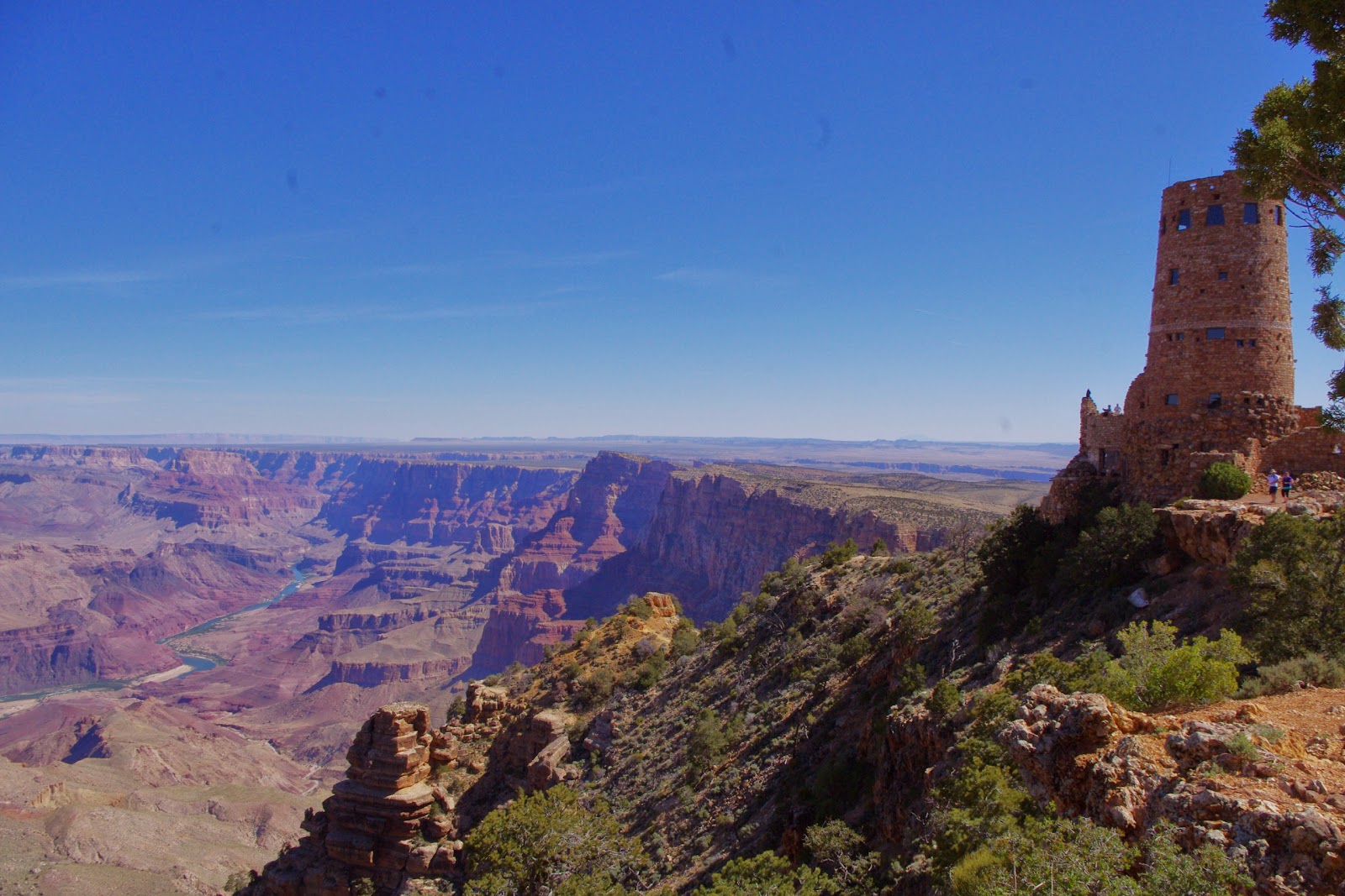 |
| Grand Canyon - Watchtower at Desertview Point |
The next day we left early to our final and
main goal: Grand Canyon. Again, we entered from a less popular entrance (the
Eastern entrance) and thanks to that we never encountered any traffic jam at
the entrance. From this entrance we picked up a few view points, like the above Desert View Point before entering the visitor center.
 |
| inside the watchtower |
At the first view point I spotted out my
favorite birds: swallows. I`ve always admired these small
but elegant birds´ amazing speed and maneuver in the air. It was even more fun
seeing them in the background of a 1800 meters deep canyon as they were playing
in the air.
After the view points along the road, we arrived to the
visitor center. Grand Canyon´s visitor center had all the usual stores
(information center, souvenir shop, cafes), but with a cool design that the
country´s most popular national park deserves. It was interesting that in the
other national parks (Zion, Bryce, Antelope, Rainbow Bridge etc.) foreigner
visitors were the majority while Grand Canyon was full with American tourists.
Although Grand Canyon was beautiful and really must be a thrill to make the
trail from the south rim to the bottom and back (which takes 2 days, 1800
meters of altitude change and about 15 degrees of temperature change), to
me Grand Canyon was just too big to perceive. The whole canyon is
449kms long and 29kms wide. In the millions of years, river Colorado cut its
way through the rocks and now it is running through the canyon in 1800meter
depth. To me, I just can´t comprehend these numbers. My home country (Hungary)
is about 500kms long – so this canyon is as long as my country??? For me Grand Canyon is just over human scale.
 |
| Grand Canyon can be even seen from space |
As you can see from the above numbers, one
can spend weeks here without getting bored. Although you might get bored from
the view (after all, it´s a deep valley all the way for 400kms!), there are a lot
of things to do: hiking on various trails, mule riding, rafting on Colorado
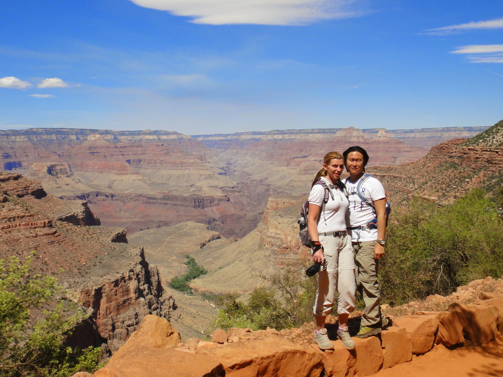
River or just driving around. We took a short (1.5 mile) hike down the valley.
Even in this short hike we could experience the temperature change from the rim
down to the valley – as we got lower in the valley the temperature got warmer
not only because of the exercise but because the wind stopped and we declined
from 2500m altitude.
 |
| on the 1.5 mile trail |
On the way we not only saw the usual ground
squirrels but even spotted out a rattle snake among the rocks.
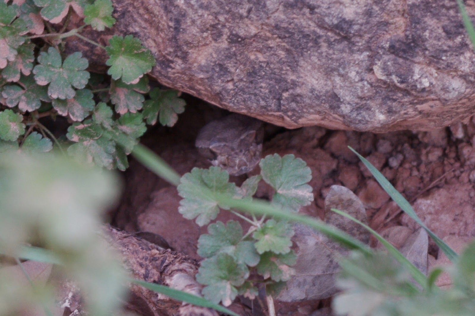 |
| rattle snake among the rocks |
And in the valley, condors could be spotted circling around.
Going down 1.5 miles was relatively easy
but the way back wasn´t that bad as well, because we more or less know the way
back. On the head of this trail was a photo- and souvenir shop with a small
photo exhibition from the Kolb brothers who (apparently) discovered a big part of
the canyon and took the first photos in the 1910s.
After this hike we strolled around in the
village a bit having some snacks and visiting the souvenir shops before we took
the bus to the western part of the park. (The western part was only accessible
by bus.) Both the bus driver and our guidebook suggested the Hopi point as the
best view for sunset, so we got off and waited for the sunset.
 |
| at Hopi Point |
We still had
over an hour until sunset, but there were already people waiting. As the sun
got lower and lower, the crowd got bigger. Looking back the pictures, the
canyon indeed looked nicer (deeper) as the shadows gave dimension to the
canyon.
 |
| not the best sunset picture in the world... |
As the spectacular daily show of the nature finished, people streamed
back to the bus stop. Fortunately the bus system was great again, already buses
lined up at the main sunset stops, so even we queued a long line, we didn´t
have to wait 10 minutes to get on a bus. By the time we got back to the parking
lot it was already dark… it was again a short day.
As we left back to Mexico the next day from
Phoenix, we spent our last night in Williams just south from Grand Canyon. Williams
lays on the historic Route 66 and although in the dark we couldn´t enjoy it
much, next day we took a small time travel to the 60´s.
 |
| Williams |

The main road is full
with souvenir shops not only with route 66 T-shirts, magnets, but Elvis stuff
as well. People gather here with antique cars, so the whole street looks like a
town in the 60´s. After a short walk in Williams we headed back to Phoenix.
Fortunately the weather was nice this time so the 200km road didn´t take much.
It was funny even the way from Phoenix to see the place-names around here. I
guess many come from the English translation of the original Indian names, as
there were names like Bloody Basin or Stoneman Lake.
Our flight was in the afternoon, so we had
a little drive around Scottsdale and visited some malls for shopping. It was
strange that just one week before it was chilly and even snowy around Flagstaff
while this time it was steaming hot: just like one would imagine of Arizona.


